» Main Index

» Search This Site
» Submit Update
» Contact Us
|
|

|
Home > Yorkshire >
Bradford > BD4
> Bowling Park
Bowling Park

|
|
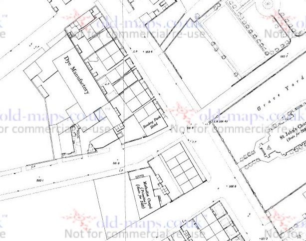
1891 Ordnance Survey
Map |
Picture source:
Hania Franek |
|
|
|
|
The Bowling Park was situated at the
junction of Wakefield Road and New Hey Road. Originally this was a Beerhouse
called the Graziers Inn. When a full licence was granted in 1881 it became
the Bowling Park, named after the new public park that opened the year
before. From 1899 to 1906 the licensee was Hannah Smith. The pub has been
demolished. |
|
|
|
Do you have any anecdotes, historical information, updates or photos of this pub? Become a contributor by submitting them here. Like this site? Follow us on

Make email contact with other ex-customers and landlords of this pub by adding your details to this page. |
|
|
|
Other Photos |
 |
|
1891 Ordnance Survey
Map |
Picture source:
John Yeadon |
|
|